
Winter Storm Hits Seven States Monday: Alaska Buried, Black Hills Slick
Warnings run into Monday night in Alaska, where the Brooks Range expects 8 to 16 inches and Atigun Pass gusts reach 55 mph. In the northern Plains, mountain snow and city slush are two different Mondays.
Key points
- Winter arrived early across seven states on Monday.
- This is a service story before it is a weather story.
- The Weather Service warning covers the southern slopes of the central Brooks Range, where total snow of 8 to 16 inches is expected, with winds gusting to 35 mph in the warning area.
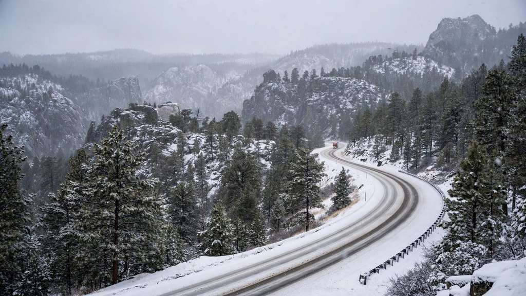
Winter arrived early across seven states on Monday. Alaska faces the serious storm, with National Weather Service warnings running into Monday night. Farther south, Colorado, Wyoming, Montana, Nebraska, South Dakota and North Dakota face early-season snow, with the Black Hills of South Dakota the commuter story of the day.
This is a service story before it is a weather story. The totals differ sharply between mountains and towns, and that difference is where Monday travel goes wrong.
Alaska: the real warning
The Weather Service warning covers the southern slopes of the central Brooks Range, where total snow of 8 to 16 inches is expected, with winds gusting to 35 mph in the warning area. The warning includes Coldfoot, Wiseman and the Dalton Highway between mileposts 165 and 232, and runs until 10 p.m. Alaska time Monday. Forecasters expect heavier snow Monday morning through evening, with an additional 4 to 8 inches on top of what fell earlier.
A separate advisory covers the central Brooks Range and Atigun Pass. It calls for 3 to 6 inches of snow and gusts up to 55 mph. Blowing snow there could cut visibility below one quarter of a mile at times. On a pass road, visibility is the danger, not the depth of snow on the ground.
The Weather Service advice for anyone who must drive is blunt: "If you must travel, keep an extra flashlight, food, and water in your vehicle in case of an emergency."
The lower 48: read the map by elevation
NOAA's Weather Prediction Center flags the Black Hills and parts of northwestern South Dakota and south-central North Dakota as the places where snow can accumulate on Monday. AccuWeather senior meteorologist Bob Smerbeck has said the Black Hills could receive several inches, with slushy conditions possible in Rapid City.
But the National Weather Service office in Rapid City projects less than half an inch for Rapid City itself. Both can be right. Mountain totals are not city totals. Snow falling in warm daylight may not stick at all in town, while the same system coats higher roads a few miles away. Snow arriving before sunrise or after sunset has a better chance to accumulate, because the ground and the air are colder.
The same slow system could also bring 1 to 3 inches of rain to parts of the northern Plains. For most drivers in Colorado, Wyoming, Montana and the Dakotas, Monday is a day of wet roads, slush at elevation and a hard freeze risk after dark, not a statewide shutdown.
What to do today
Check the warning for your county, not the headline total for your state. If your drive crosses a pass or high ground in Alaska or the Black Hills, leave margin for slow traffic and whiteout patches, and carry the basics the Weather Service lists: light, food, water, warm layers. If your trip is in a valley town, expect rain or a wet mix and refreezing after sunset.
Key numbers
- 7 states: Alaska, Colorado, Wyoming, Montana, Nebraska, South Dakota, North Dakota
- 8 to 16 inches: expected snow on the southern slopes of Alaska's central Brooks Range
- 55 mph: gusts in the Atigun Pass advisory, with visibility below one quarter mile at times
- Less than half an inch: the Weather Service projection for Rapid City itself on Monday
What happens next
Drier conditions return to northern Alaska from west to east Monday night into Tuesday, but clear skies behind the storm bring overnight temperatures into the teens and 20s, so wet surfaces can refreeze. More Bering Sea systems follow later in the week for western Alaska. For the northern Plains, Monday's snow is an early-season test of tires, crews and commutes, not yet the main winter pattern.
Timeline
- Oct 26, 2026Winter storm warning in effect for the southern slopes of Alaska's central Brooks Range until 10 p.m. AKDT.
- Oct 26, 2026NOAA's Weather Prediction Center flags the Black Hills and parts of the Dakotas for accumulating snow.
- Oct 27, 2026Drier air returns to northern Alaska, with overnight refreeze risk as temperatures fall into the teens and 20s.