
Nepal Roads Blocked: Landslides Shut Prithvi and BP Highways
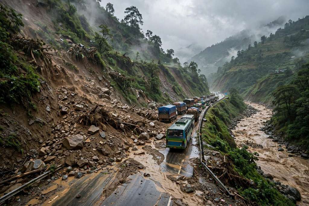
Nepal Police said more than a dozen major road sections were blocked by floods and landslides on Saturday, including the Prithvi and BP highways, as heavy rain pushed the Kulekhani Reservoir close to its limit.
Key points
- More than a dozen major road sections across Nepal were blocked by floods and landslides on Saturday, October 31, Nepal Police Headquarters said.
- The Prithvi Highway was completely blocked in both directions at Parewabhir, in Gajuri Rural Municipality-2 in Dhading district, where landslide debris covered the road.
- The Karnali Highway was fully blocked by a dry landslide at Aulise, in Barahatal Rural Municipality-7 in Surkhet, from Saturday morning.
More than a dozen major road sections across Nepal were blocked by floods and landslides on Saturday, October 31, Nepal Police Headquarters said. Persistent heavy rain left debris, mud and rising water across highways in several districts, and police listed closures on routes that link Kathmandu with the rest of the country and on regional corridors far from the capital.
Prithvi and BP highways shut
The Prithvi Highway was completely blocked in both directions at Parewabhir, in Gajuri Rural Municipality-2 in Dhading district, where landslide debris covered the road. The BP Highway was blocked at two places in Kavre district from 4:55 AM on Saturday. At Pinthali, in Roshi Rural Municipality-9, and at Gimdibesi, in Roshi Rural Municipality-8, debris and mud from a swollen seasonal stream made the road impassable.
The Karnali Highway was fully blocked by a dry landslide at Aulise, in Barahatal Rural Municipality-7 in Surkhet, from Saturday morning.
Closures spread across other routes
Other affected routes included the Mid-Hill Highway in Khotang and the Bagmati River Corridor in Lalitpur. On Kanti Lokpath, the corridor at Balkhu Sundarighat, in Lalitpur Metropolitan City-2, was impassable because of rising water.
The Kaligandaki Corridor was blocked at two locations. At Rakshe, in Kaligandaki Rural Municipality-2 in Gulmi, mud and debris closed the road. At Kasiban, in Rampur Municipality-1 in Palpa, a rock landslide fully blocked a paved section. The Nagma-Gamgadhi road was also blocked at Talcha, in Chhayanath Rara Municipality-7 in Mugu.
Rain from a weakened cyclone
Police linked the disruption to persistent heavy rainfall as Cyclone Arnab, formed in the Bay of Bengal, weakened into a powerful low-pressure system. Vibhuti Pokharel, spokesperson for the Department of Hydrology and Meteorology, said the influence of the system brought rainfall, snowfall and moderate winds.
At the Kulekhani Reservoir, the water level rose rapidly to 1,527.93 metres on Saturday morning, near the maximum storage capacity of 1,530 metres. Prahlad Raut, chief of the Kulekhani First Hydropower Centre, gave the figures. Basanta Adhikari, Chief District Officer of Makwanpur, urged residents in low-lying areas and along riverbanks to stay vigilant and said the level could pass 1,528 metres within hours.
Officials urge caution before travel
The Bharatpur Road Division advised against non-essential travel on the Muglin-Narayangadh road because of landslide risk. The Disaster Response Command Post instructed agencies to keep collecting disaster risk information, inform the public promptly and stay ready to deploy.
Pokharel advised the public to follow official updates from the department and to check weather and road conditions before travel, especially in landslide-prone areas. Farmers in the paddy harvest season should plan around forecasts, she advised.
Timeline
- Oct 31, 2026BP Highway blocked at Pinthali and Gimdibesi from 4:55 AM as debris and mud wash onto the road.
- Oct 31, 2026Prithvi Highway blocked in both directions at Parewabhir, in Gajuri Rural Municipality-2, Dhading, by landslide debris.
- Oct 31, 2026Kulekhani Reservoir reaches 1,527.93 metres on Saturday morning, near its maximum storage capacity of 1,530 metres.