
Lake Michigan Waves Could Reach 25 Feet as Gales Hit Friday
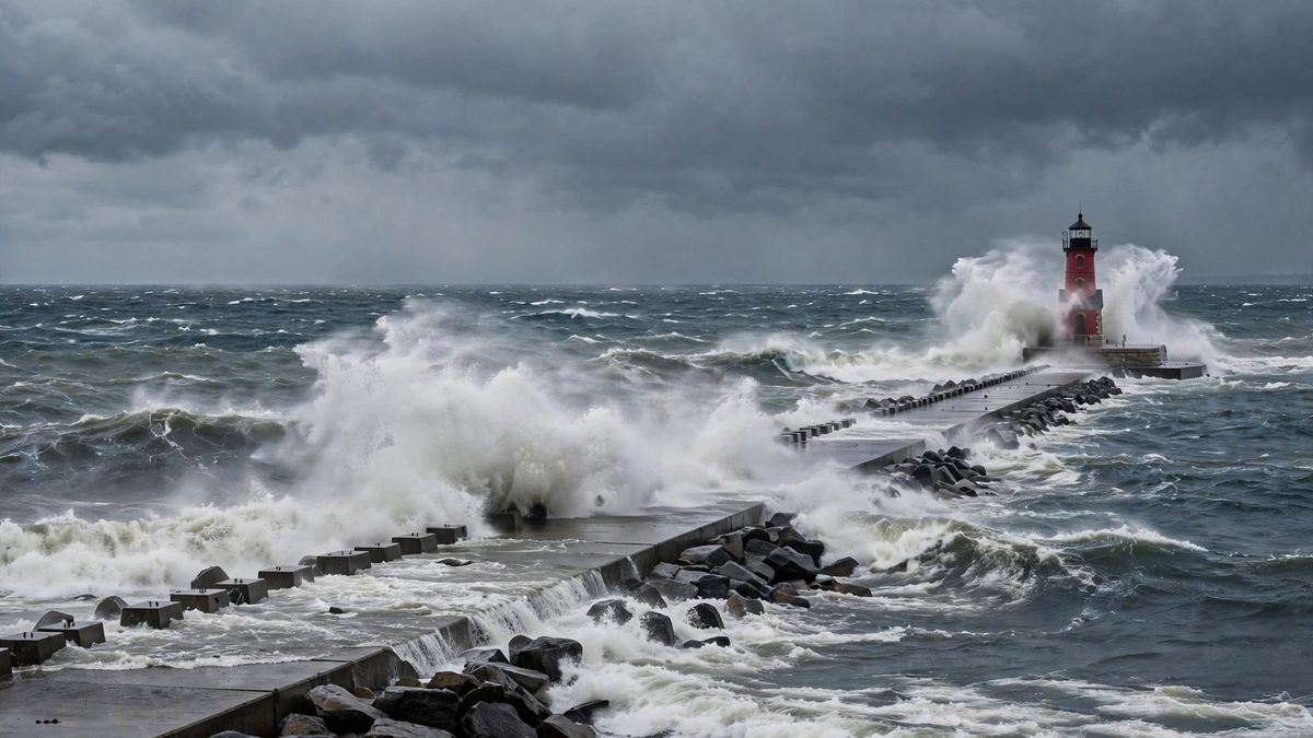
North winds near 50 mph will build waves to 20 feet in southern Lake Michigan on Friday, with occasional waves near 26 feet, the National Weather Service says.
Key points
- The Great Lakes are about to get rough.
- The strongest winds come from the north at about 50 miles per hour.
- Northern Lake Michigan is forecast to reach 16 feet, with occasional waves to 21 feet.
The Great Lakes are about to get rough. Gale force winds will sweep the lakes on Friday, October 16, and the National Weather Service expects occasional offshore waves near 26 feet in southern Lake Michigan on Friday night. The Milwaukee Journal Sentinel reported the forecast on October 15, based on the weather service outlook issued early Thursday.
The strongest winds come from the north at about 50 miles per hour. They are forecast to hit Friday afternoon and last into the night. In open water in southern Lake Michigan, from south of Sheboygan across to Pentwater, Michigan, waves are expected to build to 20 feet, with the largest occasional waves reaching 26 feet.
Lake by lake
Northern Lake Michigan is forecast to reach 16 feet, with occasional waves to 21 feet. On Lake Superior, waves off Michigan's Upper Peninsula could build to 15 to 20 feet, with occasional waves up to 25 feet, and winds there could reach storm force. Central and southern Lake Huron could see occasional waves around 18 feet. Lake Erie and Lake Ontario are forecast lower, with occasional waves around 14 feet and 10 feet.
Gale warnings cover lakes Superior, Michigan and Huron, the Detroit Free Press reported. Officials urge mariners to stay docked and change plans. Large waves can capsize or damage boats and cut visibility on the water.
Waterspouts could also form over southern Lake Michigan. Fall is peak waterspout season on the Great Lakes, when cold air passes over still warm lake water. Nearshore buoys off Milwaukee and Chicago read around 60 degrees on Thursday morning.
The cold front behind it
A cold front arrives with the wind. Rain will sweep across Michigan on Thursday and linger into Friday morning, with 1 to 2 inches possible in a 48 hour window in the wettest areas, the Free Press reported. Highs drop to the 50s in the Lower Peninsula and the 40s in the Upper Peninsula on Friday.
What happens next
The worst water is Friday afternoon into Friday night. Anyone with a boat still in the water, a pier walk planned, or a ferry crossing on the lakes should check the marine forecast again before leaving. Conditions ease after the front passes, but the lakes stay unsettled into the weekend in the Thursday outlook.
Timeline
- Oct 15, 2026The National Weather Service forecast gales and very large waves for the Great Lakes on Friday.
- Oct 16, 2026The strongest north winds are forecast Friday afternoon into Friday night, with occasional 26 foot waves in southern Lake Michigan.