
Zeballos Evacuates 22 Properties as Heavy Rain Hits Vancouver Island
A landslide risk forced an evacuation order and a state of local emergency in the British Columbia village of about 125 people, as forecasters warned of 400 millimetres of rain across a week of storms.
Key points
- The Village of Zeballos ordered 22 properties evacuated on Friday as heavy rain and a landslide risk hit the northwest coast of Vancouver Island, and a state of local emergency was declared for…
- Emergency Info BC said the evacuation order covers 101 to 118 Maquinna Avenue and 202 to 216 Pandora Crescent.
- Zeballos is a village of about 125 people.
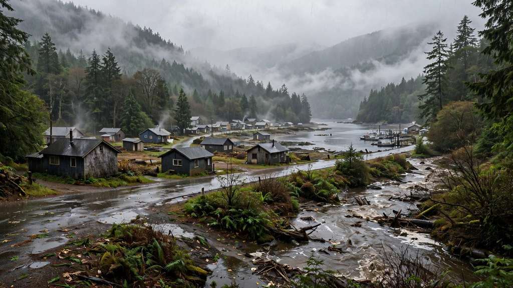
The Village of Zeballos ordered 22 properties evacuated on Friday as heavy rain and a landslide risk hit the northwest coast of Vancouver Island, and a state of local emergency was declared for the small British Columbia community.
Emergency Info BC said the evacuation order covers 101 to 118 Maquinna Avenue and 202 to 216 Pandora Crescent. The landslide risk is a threat to life and safety, and anyone in the affected area must leave now, the notice said. An evacuation alert is in effect for 402, 404 and 406 Ferris Road, where residents must be ready to leave on short notice. Other residents near Pandora, Gold Valley and Reno roads were told to stay in their homes unless officials direct otherwise.
Zeballos is a village of about 125 people. Councillor Kirsten Aubrey told The Canadian Press the village's main road was blown out at about 3:30 a.m. on Friday, and evacuees were asked to register at the Zeballos Fire Hall. The Strathcona Regional District activated its emergency operations centre and said it is monitoring flooding and landslide risks with the province. The village's chief administrative officer, Pete Nelson-Smith, said the emergency declaration could stay in place for up to 14 days.
The first big storm of the season
The evacuation came as the first major weather system of British Columbia's storm season lashed the coast. Environment Canada meteorologist Steve Boily said parts of northwest Vancouver Island had already received 140 millimetres of rain since Thursday. Rainfall warnings covered the western and northern parts of the island, with up to 150 millimetres forecast and rain rates near 10 millimetres an hour in the heaviest bands.
The BC River Forecast Centre issued high streamflow advisories across the southwest of the province. Forecasters warned that parts of Vancouver Island could receive 400 millimetres or more in total as further systems arrive over the next week. A second system is expected late Saturday into Sunday, with close to 100 millimetres for the Zeballos area, and a third system from Monday could bring up to 200 millimetres to exposed areas.
Travel and warnings
High winds prompted BC Ferries to cancel several sailings between Vancouver Island and the Lower Mainland on Friday, including all morning sailings between Swartz Bay and Tsawwassen and sailings between Nanaimo and Metro Vancouver, The Canadian Press reported. More than two dozen wind and rainfall warnings were in place across British Columbia at the height of the storm. Rainfall warnings also covered parts of Metro Vancouver, including the North Shore and Coquitlam and Maple Ridge, with up to 80 millimetres expected at higher elevations.
Key numbers
- Properties under evacuation order: 22
- Addresses on evacuation alert: 3, on Ferris Road
- Village population: about 125
- Rain recorded since Thursday in northwest Vancouver Island: 140 millimetres
- Rain forecast in warnings for the island's west and north: up to 150 millimetres
- Possible total for parts of Vancouver Island across all systems: 400 millimetres or more
- Emergency declaration length: up to 14 days
What happens next
The rain is expected to ease late Friday and into Saturday before the next system arrives on Saturday evening. Officials told residents to stay away from rivers, creeks and culverts while streamflow advisories remain in place. The evacuation order stays in force until the village and the regional district judge the slope and the flooded roads safe.
Sources
- CBC News via The Weather Network: Landslide prompts evacuation order for village of Zeballos on Vancouver Island
- Emergency Info BC: Evacuation Order issued for parts of Village of Zeballos
- Strathcona Regional District: EOC, Zeballos flooding and potential landslide risk, November 6, 2026
- The Canadian Press via EuropeSays: BC Ferries sailings cancelled as storm hits coast