
Mill Valley, California: Record High Tide Floods Streets in Southern Marin County as Advisory Is Extended Through Friday
Streets in southern Marin County flooded on Tuesday amid record high tides in San Francisco Bay. The National Weather Service extended the coastal flood advisory through 5 p.m. Friday, with up to 2.1 feet of inundation possible in low lying areas.
Key points
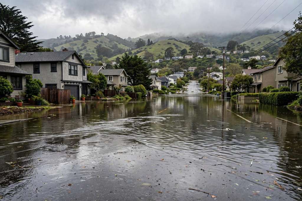
- Streets in southern Marin County, California flooded on Tuesday, Oct. 27 as a round of very high tides pushed water over low roads around San Francisco Bay.
- The National Weather Service said the San Francisco gauge reached 1.87 feet above mean higher high water on Monday, a record high for October that broke a record set on Oct. 11.
- Parts of southern Marin County saw tidal flooding on Monday and Tuesday.
Streets in southern Marin County, California flooded on Tuesday, Oct. 27 as a round of very high tides pushed water over low roads around San Francisco Bay. The flooding came a day after the tide gauge in San Francisco set a record for the month of October, and forecasters said higher water is still possible in the next few days.
The National Weather Service said the San Francisco gauge reached 1.87 feet above mean higher high water on Monday, a record high for October that broke a record set on Oct. 11. Forecasters said the record may be short lived, with higher tides expected in the next few days.
Streets flooded in southern Marin
Parts of southern Marin County saw tidal flooding on Monday and Tuesday. Streets flooded, and drivers were stranded and had to be rescued, according to CBS News Bay Area reporting carried by KION. On Tuesday the Mill Valley Police Department urged drivers to avoid Miller Avenue between Camino Alto and Almonte Boulevard because of flooding. Police also urged drivers to avoid the west side of Redwood Highway Frontage Road between Hamilton Drive and the southbound U.S. Highway 101 off ramp and on ramp.
The Town of Corte Madera had warned residents ahead of the tide cycle that high tides from Oct. 26 to Oct. 30 could flood historically affected areas. The town said observed water levels have run about one foot higher than predictions because of warmer ocean water from El Nino and windy conditions, and it pointed residents to free sandbag stations at Fire Station 14 on Tamalpais Drive and at the Paradise Drive parking lot at San Clemente Park.
Advisory extended through Friday
On Monday night the National Weather Service extended the coastal flood advisory through 5 p.m. Friday for shoreline locations along San Francisco Bay, San Pablo Bay and Monterey Bay, along with low lying parts of the coast. The weather service said up to 2.1 feet of inundation is possible in low lying coastal and bayshore areas during peak high tides.
Forecasters said rising tides will bring water and waves farther up the beach than normal, restricting escape from beaches and coastal areas. They said more substantial impacts are expected along bayshore Marin County, where increased flooding is anticipated across low lying areas. The weather service reminded drivers never to drive through flooded roads.
The Marin flooding is part of the same California king tide cycle that set an all time record at the San Pedro tide gauge in Los Angeles Harbor on Monday and flooded streets in Newport Beach in Orange County. In the Bay Area, the water is tidal flooding, not river flooding, and it rises and falls with the daily high tide. Roads that flood around midday high tide can drain later, then flood again at the next high tide while the advisory lasts.
Timeline
- Oct 26, 2026The San Francisco tide gauge reaches 1.87 feet above mean higher high water, a record high for October, breaking a record set on Oct. 11. Southern Marin streets flood at high tide.
- Oct 27, 2026Streets in southern Marin County flood again on Tuesday. Mill Valley police urge drivers to avoid Miller Avenue between Camino Alto and Almonte Boulevard and part of Redwood Highway Frontage Road.
- Oct 27, 2026The National Weather Service advisory for the Bay Area shoreline is in effect through 5 p.m. Friday, with up to 2.1 feet of inundation possible at peak high tides.
Sources
- KION Central Coast, CBS News Bay Area: Widespread flooding in southern Marin County amid record high tides, flood advisory extended
- KION Central Coast, CBS News Bay Area: Coastal Flood Advisory extended, San Francisco high tide sets record
- Town of Corte Madera: High Tides and Possible Flooding 10/26 to 10/30