
Cocoa, Florida: St. Johns River in Major Flood as Flood Watch Covers Nine Counties
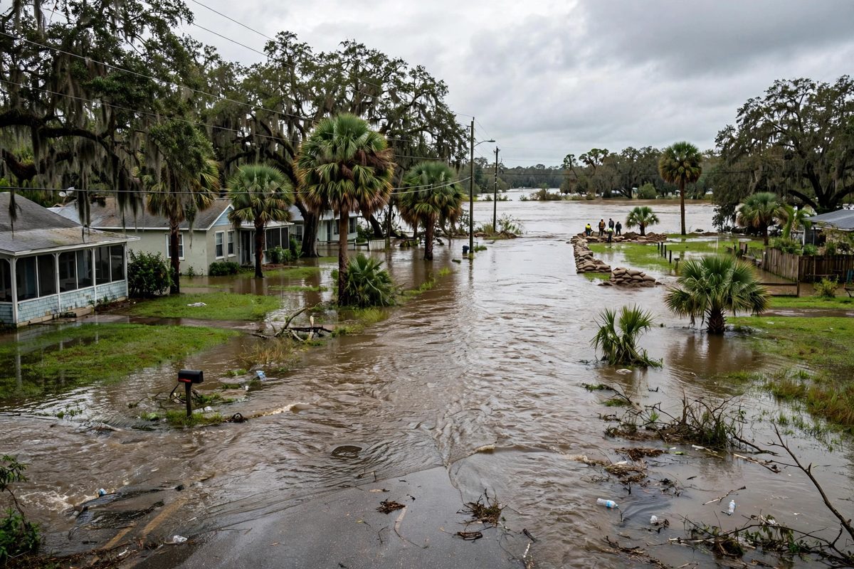
The river near Cocoa stood at 17.0 feet on Monday morning, a foot over flood stage, before the National Weather Service put nine counties under a flood watch through Friday. Brevard County will hand out free sandbags on Tuesday in Cocoa, Melbourne and Palm Bay.
Key points
- The St. Johns River near Cocoa reached 17.2 feet on Wednesday morning, November 18, earlier than forecasters had expected, and the National Weather Service in Melbourne now forecasts a crest of…
- Florida Today reported in live updates that the river topped the 17.2 foot threshold by about 7 a.m. Wednesday, earlier than the early Thursday timing forecasters had expected.
- At 17.2 feet, water enters homes along the St. Johns River in the Lake Poinsett area west of Cocoa, and low lying homes in the Silver Pines subdivision in Rockledge and the Shakespeare Park area…
Updated 17:11 UTC, November 18: River reaches 17.2 feet early, crest now forecast at 17.4 feet by Saturday
The St. Johns River near Cocoa reached 17.2 feet on Wednesday morning, November 18, earlier than forecasters had expected, and the National Weather Service in Melbourne now forecasts a crest of 17.4 feet by Saturday, November 21. At 8:15 a.m. EST on Wednesday the gauge read 17.2 feet, in major flood stage. Flood stage at the Cocoa gauge is 16.0 feet, bankfull stage is 15.8 feet, and major flood stage begins at 17.0 feet.
Florida Today reported in live updates that the river topped the 17.2 foot threshold by about 7 a.m. Wednesday, earlier than the early Thursday timing forecasters had expected. The forecast crest of 17.4 feet by Saturday afternoon sits close to the record of 17.6 feet, set in October 1953.
At 17.2 feet, water enters homes along the St. Johns River in the Lake Poinsett area west of Cocoa, and low lying homes in the Silver Pines subdivision in Rockledge and the Shakespeare Park area of Cocoa, the weather service said. Providence Road west of Cocoa becomes impassable at that level. The earlier forecast in this report, which had the river reaching 17.2 feet by 1 a.m. on Friday, is superseded by the Wednesday morning reading and the new Saturday crest forecast.
Updated 14:32 UTC, November 18: Heavy rain keeps falling as state warns of potentially catastrophic totals
Heavy rain kept falling across east central Florida on Wednesday, November 18, and flood watches and warnings stayed in effect along almost the whole east coast, as far west as Orlando and Kissimmee, Florida Today reported in live updates. The Florida Division of Emergency Management warned on Tuesday that a considerable to potentially catastrophic rainfall event is expected across the Florida east coast through Saturday, November 21, with widespread amounts of 4 to 8 inches along the immediate coast and isolated totals that could exceed 12 to 16 inches.
The Weather Prediction Center said a widespread, potentially significant heavy rain event would continue on Wednesday, with a moderate risk of excessive rainfall, level 3 out of 4, for the Space and Treasure Coasts. National Weather Service meteorologist Scott Kelly in Melbourne put the moderate risk from Fort Pierce through Daytona for Wednesday. Daytona Beach recorded 2.19 inches of rain on Tuesday, a record for the date, and Melbourne recorded 2 inches from 7 a.m. Tuesday to 7 a.m. Wednesday, plus another 1.3 inches between 1 a.m. and 7 a.m. Wednesday, the weather service said.
Forecasts showed the St. Johns River near Cocoa would most likely stay at its current major flood stage, 17.1 feet, until Thursday, November 19, then rise to 17.2 feet by 1 a.m. on Friday, the level at which water can enter homes in several Brevard County neighborhoods. St. Lucie County schools closed on Wednesday because of the forecast heavy rain, and all after school activities were canceled. Forecasters said the ground is already saturated from the heavy rain earlier this month, so any additional rain could cause flash flooding quickly.
Updated 21:15 UTC, November 17: Flash flood risk area expands from Melbourne through Jacksonville
The Weather Prediction Center has raised its flash flooding risk to a rare moderate level for more days this week and for a larger area, now running from about Melbourne through Jacksonville, the Daytona Beach News-Journal reported in its live updates on Tuesday. Flood warnings are in effect for the entire East Coast of Florida, according to NOAA.
Weather Prediction Center meteorologist Ashton Robinson Cook said this is only the second time a moderate risk level has been issued for Florida in November in records dating back to 2016, and the first time was during the November 1 to 3 event. The center said models show heavy rainfall prospects with a bullseye centered near St. Augustine on Day 4, Friday, November 20.
National Weather Service meteorologists in Jacksonville said widespread rain of 4 to 8 inches is expected over the next four days, with 8 to 12 or more inches possible for coastal communities.
Updated 19:50 UTC, November 17
The flood watch is now in effect across Florida's east coast through Friday evening, November 20, and the risk picture for Wednesday has been raised. The Weather Prediction Center has issued a moderate risk of rainfall-driven flash flooding for the area between about Melbourne and Titusville for Wednesday, November 18 into early Thursday, only the third time that level has been issued for Florida in November since 2016, according to a center meteorologist. The National Weather Service expects 3 to 6 inches of rain along the east coast this week, with local totals of 8 to 12 inches or more possible. On the Treasure Coast, the watch runs from Tuesday afternoon through Friday evening, with 3 to 4 inches expected in Vero Beach, Fort Pierce and Stuart and a 5 percent chance of 8 to 12 inches in local spots. St. Lucie County public schools released students two hours early on Tuesday and the Indian River County district used a modified schedule. Fort Pierce closed all city parks, recreation facilities and beach access points from 2 p.m. on Tuesday as a precaution. New Smyrna Beach is handing residents up to 15 sandbags each at 124 Industrial Park Avenue, from noon to 5 p.m. on Tuesday and 8 a.m. to 5 p.m. Wednesday through Friday. The St. Johns River near Cocoa remains in major flood, and a flood warning continues for four counties along the river, which forecasters expect to reach 17.2 feet by 1 a.m. on Friday.
The St. Johns River near Cocoa is in major flood, and forecasters have put nine east central Florida counties under a flood watch from Tuesday afternoon through Friday evening, with 3 to 6 inches of rain expected and local totals of 8 to 12 inches possible along the coast.
The National Weather Service office in Melbourne issued the watch at 3:18 p.m. on Monday. It covers Volusia, Seminole, Orange, Osceola, Okeechobee, Brevard, Indian River, St. Lucie and Martin counties, and it runs from Tuesday afternoon through 7 p.m. on Friday.
The river is already over its banks
River flood warnings were already in effect before the watch was issued. Near Cocoa, the St. Johns River stood at 17.0 feet at 9:15 a.m. on Monday, a full foot over its 16.0 foot flood stage, and forecasters said major flooding was occurring and would continue. At 17.2 feet, water starts entering homes along the river in the Lake Poinsett area west of Cocoa, and low lying homes in Rockledge and Cocoa are at risk.
Near Lake Harney in Seminole County, the river measured 9.0 feet at 8:30 a.m. on Monday, a foot over its flood stage. Near Astor, on the Lake and Volusia county line, it stood at 2.6 feet against a flood stage of 2.3 feet. Those warnings stay in effect until further notice, separate from the new rain watch.
Sandbags on Tuesday
Brevard County will give out free sandbags all day Tuesday, from 7 a.m. to 6 p.m. or until dark, at three sites in Cocoa, Melbourne and Palm Bay, the county emergency management office said. Titusville residents can fill sandbags at a self service site at 385 N. Singleton Ave.
The county is still recovering from the rain earlier this month, when more than 20 inches fell in less than 24 hours in some places south of U.S. 192. Brevard Emergency Management Communications Director Don Walker told Central Florida Public Media that this event will be spread over days, which gives people time to prepare now.
Because the St. Johns River flows north, more rain in Brevard County this week could raise levels farther north, including in Volusia County. Volusia officials are telling residents in low lying coastal areas and near waterways to review their household emergency plans.
What a watch means
A flood watch means conditions are right for flooding, not that flooding is certain in every place covered. A flood warning, like the ones already posted on the St. Johns River, means flooding is happening or about to happen. Forecasters said the coast south of Cape Canaveral faces the greatest flooding concern, especially on Wednesday and Thursday, and they also expect rough surf, a high risk of rip currents and possible minor beach erosion through the week.
Drivers should not cross flooded roads. The weather service says water can hide a washed out road surface, and shallow moving water can carry a car. The next river statement from the Melbourne office is expected late Monday night, and it may change the crest forecast for the Cocoa gauge.
Timeline
- Nov 2, 2026More than 20 inches of rain falls in less than 24 hours in parts of Brevard County south of U.S. 192, flooding roads and homes and starting a long recovery.
- Nov 16, 2026At 9:15 a.m., the St. Johns River near Cocoa reads 17.0 feet, over its 16.0 foot flood stage, with major flooding occurring under a river flood warning.
- Nov 16, 2026At 3:18 p.m., the National Weather Service in Melbourne issues a flood watch for nine counties, from Tuesday afternoon through Friday at 7 p.m., forecasting 3 to 6 inches of rain with local totals of 8 to 12 inches.
- Nov 17, 2026Brevard County offers free sandbags from 7 a.m. to 6 p.m. in Cocoa, Melbourne and Palm Bay, and the flood watch takes effect Tuesday afternoon.
- Nov 17, 2026The flood watch takes effect Tuesday afternoon through Friday evening. The Weather Prediction Center raises a moderate flash flood risk for the Melbourne to Titusville area for Wednesday. Treasure Coast schools release students early and Fort Pierce closes parks and beach access from 2 p.m.
- Nov 17, 2026The Weather Prediction Center expands its rare moderate flash flood risk to an area from about Melbourne through Jacksonville for more days this week, and flood warnings are reported in effect for the entire Florida East Coast.
- Nov 18, 2026Heavy rain continues on Wednesday. The Weather Prediction Center keeps a moderate, level 3 out of 4, excessive rainfall risk for the Space and Treasure Coasts, Daytona Beach reports a record 2.19 inches for Tuesday, and St. Lucie County schools close for the day.
- Nov 18, 2026The St. Johns River near Cocoa reaches 17.2 feet by about 7 a.m., earlier than forecast, reads 17.2 feet at 8:15 a.m. in major flood stage, and forecasters raise the crest to 17.4 feet by Saturday, close to the 17.6 foot record from October 1953.
Sources
- Central Florida Public Media: Flooding a concern again this week for Brevard, east Central Florida coast
- The FINANCIAL: Central Florida flood watch issued as coastal rain totals could reach 12 inches
- The Weather Channel: Cocoa, Florida hourly forecast and alerts
- TCPalm: Flood watch issued for Treasure Coast this week with 3-4 inches rain
- Daytona Beach News-Journal: Live updates, Florida braces for heavy rain again, 12 inches possible
- Florida Today: Live updates, potentially catastrophic rainfall targets Florida
- FOX Weather: Relentless rain triggers South Florida flash flooding as weeklong flood threat intensifies
- National Weather Service Melbourne: Flood warning, St. Johns River near Cocoa
- Florida Today: Live updates, flooding risk remains high in Brevard