
Tornado Watch Covers Northern Arizona After Six Warnings in One Morning
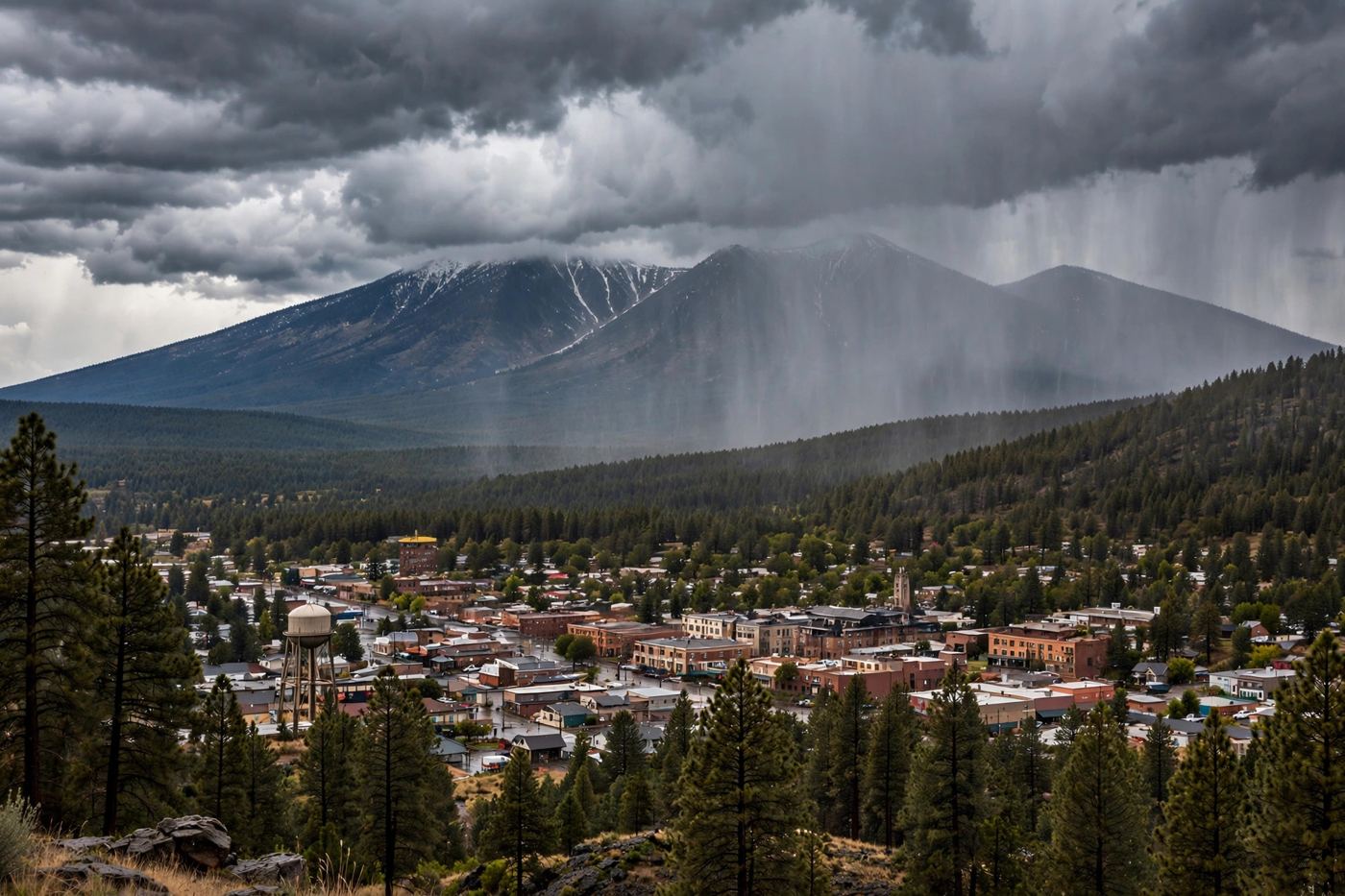
The National Weather Service put Coconino, Navajo and Yavapai counties under a Tornado Watch until 6 p.m. on Wednesday after six radar based tornado warnings in northern Arizona, while the same storms uprooted trees and damaged cars in Mesa on Tuesday night. No tornado had been confirmed on the ground.
Key points
- A possible tornado struck the Heber-Overgaard area in Navajo County on Wednesday evening, damaging homes, knocking down power poles and cutting power, according to local officials and news reports.
- The National Weather Service in Flagstaff issued a tornado warning at 7:02 p.m. MST on October 21 for Navajo County.
- State Rep.
Updated 06:41 UTC, Oct 22, 2026: Possible tornado damages homes in Heber-Overgaard, emergency declaration requested
A possible tornado struck the Heber-Overgaard area in Navajo County on Wednesday evening, damaging homes, knocking down power poles and cutting power, according to local officials and news reports. At least one person was injured. The National Weather Service has not confirmed that a tornado touched down.
The National Weather Service in Flagstaff issued a tornado warning at 7:02 p.m. MST on October 21 for Navajo County. A severe thunderstorm capable of producing a tornado was over Heber-Overgaard, moving northeast at 40 mph, with rotation shown on radar and half dollar size hail. A severe thunderstorm warning for the same area ran until 7:30 p.m. MST.
State Rep. Walt Blackman, who represents the area, called on Gov. Katie Hobbs to declare a state of emergency in Navajo County and send state resources. "The people of Heber need immediate assistance. We have families without power, significant property damage, and at least one reported injury," Blackman said. He said he plans to visit the area on Thursday afternoon, and listed his first tasks as restoring power, clearing blocked roads, helping displaced residents and securing state aid.
The Navajo County Sheriff's Office said it was responding to a major incident in the Overgaard area and asked drivers to stay away from State Route 260 between Mogollon and the Overgaard Airpark, and from areas north of State Route 377 toward Tonto. Navopache Electric Cooperative reported outages, with no count of affected customers and no estimate for restoration. One Heber resident, Betty Nixon, told the Phoenix Focal that the wind and flying debris hit her home for about 30 to 45 seconds while she sheltered on the floor with her dogs. A large section of a neighbor's tree landed in her yard, and another neighbor's windows were reported shattered.
Flooding hit the north of the state the same night. The National Weather Service in Flagstaff extended a Flash Flood Warning for the Moenkopi Wash in Coconino County until 2 a.m. MST on October 22. A river gauge read 33.54 feet at 8:45 p.m. MST on October 21, above major flood stage and well above the 27 foot flood stage. Forecasters said life threatening flash flooding was already happening around Moenkopi and Tuba City, where the water can reach homes in lower Moenkopi Village, and more heavy rain was expected overnight.
Updated 02:45 UTC, Oct 22, 2026: Watch expires, no tornado confirmed
The Tornado Watch for Coconino, Navajo and Yavapai counties expired at 6 p.m. MST on Wednesday, and no tornado was confirmed on the ground anywhere in northern Arizona during the day. Every warning on Wednesday was based on rotation seen on radar.
The storms still landed hard in Flagstaff. Hail the size of golf balls, 1.75 inches across, was reported in the downtown area, and a gust of 72 mph was recorded at Flagstaff Airport, The Weather Channel reported in its recap of the day. The watch was the first tornado watch issued for northern Arizona in more than 16 years.
The wider system is not done. Forecasters said a flood risk runs through Thursday across the Southwest, and Arizona again sits under the greatest severe storm risk in the region on Thursday.
The National Weather Service in Flagstaff placed Coconino, Navajo and Yavapai counties under a Tornado Watch on Wednesday. The watch took effect at 10:10 a.m. MST and runs until 6:00 p.m. MST on October 21. It followed six tornado warnings in northern Arizona that morning. No tornado had been confirmed on the ground. The same storm system had hit Mesa the night before, where wind uprooted trees and damaged cars on Tuesday night.
The first warnings came early. Forecasters issued the first three tornado warnings around 5 a.m. for parts of Coconino County and Yavapai County. Another warning followed for the Prescott area shortly before 8 a.m. A warning for Jerome came soon after. Each warning pointed to rotation seen on radar, not a tornado seen on the ground.
Flagstaff warning covers downtown
The sixth warning came at 9:22 a.m. MST. It covered downtown Flagstaff. The storm was over the city and moving north at 45 mph, with quarter size hail. The warning area included Northern Arizona University, East Flagstaff, Fort Valley and Doney Park. It also covered stretches of Interstate 40 and Interstate 17. The warning expired at 9:45 a.m.
An earlier warning at 5:49 a.m. had covered an area near Fort Valley, about 11 miles northwest of Flagstaff. That storm was moving northeast at 35 mph. All six warnings on Wednesday morning were radar based. Forecasters said they saw rotation in the storms. By late morning, no tornado had been confirmed on the ground in northern Arizona.
Mesa damage from Tuesday night storms
In Mesa, residents at the Talise Apartments near Gilbert Road and University Drive woke to damage from Tuesday night. Wind uprooted trees at the complex. A branch fell on a carport, bent the structure and damaged a vehicle below. Other trees fell on cars, and windshields shattered.
The National Weather Service in Phoenix had issued a severe thunderstorm warning for Maricopa County that ran until 10:30 p.m. on Tuesday. The storm was over the Fiesta Mall area, about five miles east of Tempe, and moving northeast at 35 mph. Forecasters listed gusts of 60 mph and hail up to 1.25 inches.
Hail, wind and flooding lead the rest of Wednesday
Forecasters said the biggest risk for the rest of Wednesday was large hail over an inch across. Hail of two inches or more was possible in southern Coconino County, including Flagstaff, in eastern Yavapai County, including Prescott, and in northern Gila County, including Payson. Damaging winds over 60 mph were also possible.
The tornado chance was put at 5 percent, in an area from western Mohave County to northern Gila County and northeastern Maricopa County. Rain could fall at one to two inches an hour. That rate raises the risk of flash flooding. A Flood Watch runs through Thursday evening for northern and central Arizona.
Watch means be ready, warning means act
A watch means be ready. A warning means act. If a warning is issued for your area, go to an interior room on the lowest floor of a sturdy building and stay away from windows. Do not wait to see the storm. Never drive across a flooded road. Turn around and find another route.
Timeline
- Oct 20, 2026A severe thunderstorm warning covers Maricopa County on Tuesday night, and wind uproots trees and damages cars at the Talise Apartments in Mesa.
- Oct 21, 2026The National Weather Service in Flagstaff issues the first tornado warnings around 5 a.m. MST for parts of Coconino and Yavapai counties.
- Oct 21, 2026A tornado warning at 9:22 a.m. MST covers downtown Flagstaff, with a storm moving north at 45 mph and quarter size hail. It expires at 9:45 a.m.
- Oct 21, 2026A Tornado Watch takes effect at 10:10 a.m. MST for Coconino, Navajo and Yavapai counties and runs until 6:00 p.m. MST.
- Oct 21, 2026The Tornado Watch expires at 6 p.m. MST with no tornado confirmed on the ground. Golf ball size hail, 1.75 inches across, falls in downtown Flagstaff and a gust of 72 mph is recorded at Flagstaff Airport.
- Oct 21, 2026A tornado warning at 7:02 p.m. MST covers Heber-Overgaard in Navajo County. A possible tornado damages homes and knocks down power poles, at least one person is injured, and State Rep. Walt Blackman asks Gov. Katie Hobbs to declare a state of emergency in Navajo County.
- Oct 22, 2026A Flash Flood Warning for the Moenkopi Wash near Tuba City runs until 2 a.m. MST, with the wash at 33.54 feet, above major flood stage and well above the 27 foot flood stage.
Sources
- Arizona Republic: Severe storm takes aim at Arizona with rain, hail, possible tornado
- Arizona Republic: Severe weather chances increase in Arizona, with hail, tornado risks
- Phoenix Focal: Mesa storm uproots trees as northern Arizona sees six tornado warnings
- The Weather Channel: Flood risk, severe storms threat from California to Colorado
- FOX 10 Phoenix: Heber storm damage prompts call for Arizona state of emergency declaration
- Phoenix Focal: Heber-Overgaard storm damages homes, cuts power; sheriff urges drivers to avoid roads