
Salt Lake City, Utah: Wasatch Winter Storm Warning Calls for 12 to 24 Inches of Snow Through Saturday
The National Weather Service in Salt Lake City kept a winter storm warning in effect for the Wasatch Mountains until 11 a.m. MST Saturday, with the heaviest snow in the Upper Cottonwoods and near the Utah and Idaho border, and advisories covering Park City and the Wasatch Back for both Friday commutes.
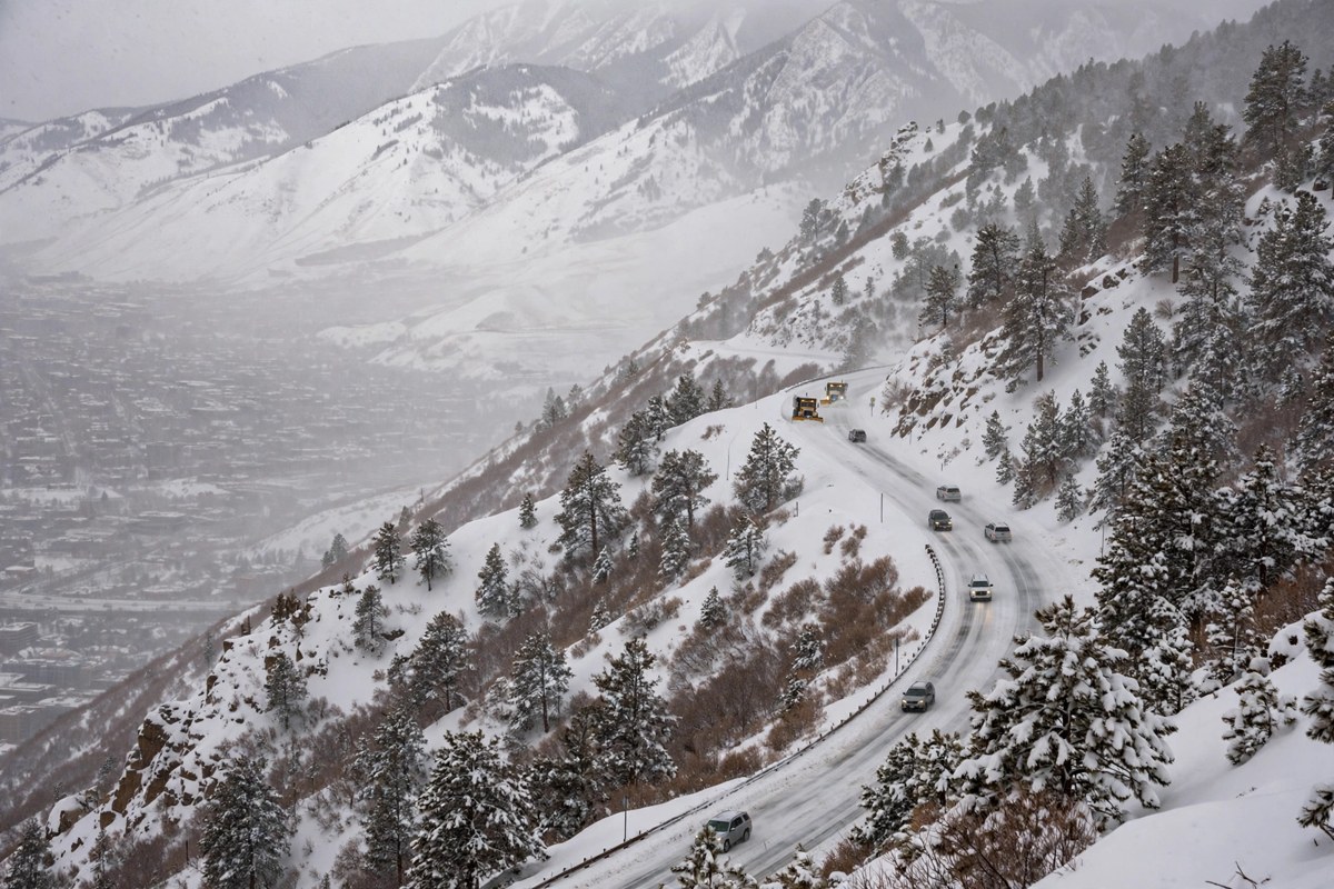
Key points
- SALT LAKE CITY, Utah.
- The heaviest snow is expected in the Upper Cottonwoods and in the mountains near the Utah and Idaho border, the weather service said.
- Winter driving conditions are expected across the warned area, and roads, especially bridges and overpasses, will likely become slick and hazardous, the weather service said.
SALT LAKE CITY, Utah. The Wasatch Mountains are under a winter storm warning until 11 a.m. MST on Saturday, with 12 to 24 inches of snow expected in the range above Salt Lake City, the National Weather Service in Salt Lake City said in an update issued at 10:20 p.m. MST on Thursday.
The heaviest snow is expected in the Upper Cottonwoods and in the mountains near the Utah and Idaho border, the weather service said. The warning covers the Wasatch Mountains north and south of Interstate 80, including Brighton, Alta, Mantua and Logan Summit.
What drivers face on Friday
Winter driving conditions are expected across the warned area, and roads, especially bridges and overpasses, will likely become slick and hazardous, the weather service said. The service told people to delay all travel if possible, and said anyone who must travel should drive with extreme caution, leave extra room ahead, allow extra time, and keep an extra flashlight, food and water in the vehicle in case of an emergency. Road conditions from the Utah Department of Transportation are posted at udottraffic.utah.gov.
A winter weather advisory also remains in effect for the Wasatch Back, including Park City, Heber City and Huntsville, until 5 a.m. MST on Saturday, with 4 to 8 inches expected in the Park City area and the Ogden Valley and lower totals near Heber City. The weather service said the conditions there could affect the Friday morning and evening commutes.
The Western Uinta Mountains, including Moon Lake and the Mirror Lake Highway, are under an advisory until 11 a.m. MST on Saturday for 6 to 12 inches. In the Southern Mountains, including Alton and Brian Head, an advisory runs until 5 p.m. MST on Friday for 3 to 7 inches above 6,500 feet, with totals up to 12 inches in the Tushars and the Brian Head area and wind gusts as high as 50 mph.
A sharp change from last season
The storm follows a historically dry snow season in Salt Lake City. The city collected just 3.7 inches of snow all of last season, the lowest total since records began in 1874, according to the Deseret News reporting cited by Men's Journal. The city picked up its first valley snow of this season on Wednesday, and forecast models cited by KSL showed the Wasatch collecting another 8 to 18 inches between Thursday and Friday, with the best chance for valley snow arriving Friday afternoon and evening.
Men's Journal reported on Friday morning that forecasters had upgraded the earlier advisory to a warning on Thursday morning, and that the warning runs until 11 a.m. MST on Saturday, November 21. The weather service first issued the warning at 9:33 a.m. MST on Thursday and kept it in effect in the 10:20 p.m. update.
For Salt Lake City readers, the practical point is timing. Mountain travel gets harder through Friday, the Wasatch Back advisory covers both Friday commutes, and the warning does not lift until late Saturday morning. Anyone headed for Brighton, Alta, Park City or Logan Summit should check UDOT conditions before leaving and be ready to delay the trip.
Timeline
- Nov 19, 2026The National Weather Service in Salt Lake City issues a winter storm warning for the Wasatch Mountains at 9:33 a.m. MST, calling for 12 to 24 inches of snow.
- Nov 19, 2026In a 10:20 p.m. MST update, the weather service keeps the warning in effect, with the heaviest snow in the Upper Cottonwoods and near the Utah and Idaho border.
- Nov 21, 2026The winter storm warning for the Wasatch Mountains is set to remain in effect until 11 a.m. MST Saturday.