
Pacific Storm Brings Sierra Snow Warnings and 35 Foot Surf to California and Oregon
The biggest Bay Area waves in more than a decade flooded Pacifica streets on Saturday, reached homes and businesses and damaged Capitola Wharf, while Sierra storm warnings ran into Saturday morning.
Key points
- Updated 09:56 UTC, November 15
- Emergency crews in Fort Bragg responded shortly before 9 a.m. Saturday after two people were reported in the water at Noyo Bay, Mendocino Local News reported.
- In Santa Cruz County, about 270 homes were under evacuation warnings, The New York Times reported.
Updated 09:56 UTC, November 15
Two in the water at Fort Bragg and 270 homes warned as the swell rolls on
Emergency crews in Fort Bragg responded shortly before 9 a.m. Saturday after two people were reported in the water at Noyo Bay, Mendocino Local News reported. Both people made it back to the beach. One had a head injury and was taken to a hospital. The Mercury News also reported that two people in Mendocino County were swept into the water, survived, and that one was taken to a local hospital. How the two ended up in the water was not clear in the first reports. Reports citing Coast Guard information said cars were washed around in Noyo Harbor in Fort Bragg, and debris blocked Highway 1 on the Mendocino coast on Saturday afternoon.
In Santa Cruz County, about 270 homes were under evacuation warnings, The New York Times reported. County spokesman Jason Hoppin said at midday Saturday that there were a few road closures, no evacuation orders had been issued, and flooding so far was minor, with infrastructure holding up. Capitola police later closed Capitola Village, saying wave height and power had pushed seawater into the village. Police said occupants of the Venetians should leave water facing units at once, and residents in the 100 blocks of Esplanade and Monterey Avenue should shelter in place or leave the village voluntarily. The closures were in effect until further notice.
National Weather Service meteorologist Rachel Kennedy told the Los Angeles Times that waves topped 25 feet along much of the coast, with more localized sets of 50 to 60 feet at Mavericks, off Half Moon Bay. The weather service Bay Area office said at 5:51 p.m. Saturday that the High Surf Warning remained in effect until 4 a.m. Sunday, with breaking waves of 25 to 35 feet and occasional sets of 40 to 50 feet at favored breakpoints. Forecasters still expected a second large swell late Sunday into Monday.
Updated 01:37 UTC, November 15
Biggest waves in a decade flood Pacifica streets and damage Capitola Wharf
The biggest waves in more than a decade slammed the Bay Area coast on Saturday, flooding streets in Pacifica, reaching homes and businesses, and sending onlookers running from sneaker waves, the San Francisco Chronicle reported.
Pacifica took some of the heaviest hits. Waves crashed over the seawall and water ran across Beach Boulevard. Debris including rocks and kelp surrounded the Taco Bell Cantina on Highway 1, where nearly a foot of floodwater blocked cars from entering the parking lot. The Chronicle said a relatively low tide limited the damage. The National Weather Service Bay Area office told people not to go to the beach or coast on Saturday. It said buoy 46042 hit 32 feet at 21 seconds on Saturday morning, and that fully exposed beaches could see waves over 40 feet with sets in excess of 60 feet.
Off Point Reyes, significant wave heights hit 31 feet at 9 a.m. Saturday, the Chronicle reported. That was the second largest reading in three decades of records at that buoy, behind only a December 2015 storm. National Weather Service meteorologist Rachel Kennedy told the Los Angeles Times the reading was the highest since 2015. The Scripps Institution of Oceanography said wave heights of this size in November are virtually unprecedented in the 27 year history of the Point Reyes buoy.
In Capitola, a wave slammed into the Capitola Wharf around 12:30 p.m. Saturday and shredded a railing, in video shared with KSBW, the New York Post reported. No injuries were immediately reported. The wharf reopened in 2024 after more than 8 million dollars in reconstruction work following severe storm damage in 2023.
Forecasters expected a second large swell late Sunday into Monday, with rough seas through the week as more Pacific storms move in.
Surf arrives Saturday: evacuation warnings in Santa Cruz County, piers and beaches closed
The large swell forecast in this article reached the California coast on Saturday. Towering surf crashed ashore along the West Coast, and officials closed beaches, piers and coastal roads from Santa Cruz County to Southern California.
The Santa Cruz County Sheriff's Office and the Capitola Police Department issued evacuation warnings at 2 p.m. Friday for low-lying coastal zones: Capitola Village, the Esplanade and the Venetian; the Las Olas Drive and Beach Drive area of Rio Del Mar in Aptos, including Platform Beach; and the Potbelly Beach and New Brighton State Beach area. The sheriff's office said large waves could reach coastal homes and properties, cause dangerous flooding and make access difficult or unsafe. No evacuation orders had been issued in the county's Friday update. The City of Santa Cruz closed all city beaches and the Santa Cruz Wharf from Friday night through early Sunday.
Buoys recorded the swell as it arrived. A buoy west of San Francisco measured waves of 34.1 feet on Friday afternoon, about 19 seconds apart. The Bodega Bay buoy reported significant wave heights of about 28 feet early Saturday. The weather service office in Eureka said a very large northwest swell of 27 to 30 feet arrived late Friday and early Saturday and peaked early Saturday. The Bay Area office said breaking waves of 25 to 35 feet were expected on Saturday, with occasional sets of 40 to 50 feet at favored breaks such as Mavericks near Half Moon Bay, under a High Surf Warning in effect until 4 a.m. Sunday. The office said the risk of drowning is very high this weekend and told people not to go in the water, climb on rocks or lean over seawalls.
In Monterey County, public safety agencies closed beaches and coastal turnouts from Friday evening until Sunday morning, with a likely extension through Tuesday. The closures included San Carlos and McAbee beaches in Monterey, turnouts in Pacific Grove and Pebble Beach, Carmel River State Beach, Garrapata Beach, Point Lobos State Natural Reserve and Asilomar State Beach. SFGate reported that 17-Mile Drive in Pebble Beach was closed to visitors.
Farther south, the weather service office in Los Angeles and Oxnard kept a Coastal Flood Warning in place for San Luis Obispo County beaches and the Central Coast beaches of Santa Barbara County from 3 a.m. to 6 p.m. Saturday, with a High Surf Warning for breaking waves of 18 to 25 feet until 3 a.m. Sunday. The office said seawater could flood beaches, walkways and roads and could damage some structures, with widespread flooding likely at Oceano Dunes. The Pismo Beach Pier was closed, and beach camping at Oceano Dunes was canceled. In Los Angeles County, the City of Manhattan Beach closed the Manhattan Beach Pier on Saturday morning because of high surf and hazardous wave conditions and said pedestrian access was prohibited until further notice.
The Coast Guard said it was prepared to respond along the California coast through Sunday morning. Lt. John Corvino, a search and rescue mission coordinator with Coast Guard Sector San Francisco, urged mariners and beachgoers to follow Coast Guard and weather service updates, never turn their backs on the ocean, wear life jackets and carry reliable communications equipment. As of early Saturday, no deaths, injuries or rescues tied to the surf had been reported in the official sources reviewed for this update.
Forecasters said the break will be short. Santa Cruz County urged residents not to return to the coast when conditions calm on Sunday because a second swell is expected on Monday, and the Central Coast could see warning-level surf return late Sunday night through Monday.
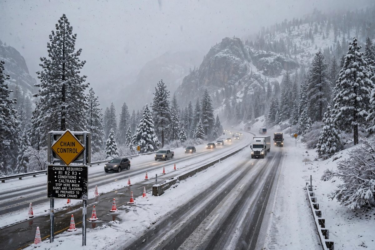
The first in a series of Pacific storms reaches California and southern Oregon on Friday, and the National Weather Service has winter storm warnings in place across the Sierra Nevada and high surf warnings along the coast from Oregon to Big Sur. The Sierra warnings take effect at 10 a.m. Pacific time on Friday and run to 10 a.m. Saturday. Forecasters expect the heaviest snow on Friday night into Saturday morning.
Snow in the Sierra
The Sacramento office of the weather service warns of snow above 6,000 feet in the northern Sierra, including Interstate 80, U.S. Highway 50, State Route 4 and State Route 108, and in the southern Cascades, including Lassen Volcanic National Park. Totals could reach a foot, with up to 2 feet on the highest peaks, and winds could gust as high as 60 mph. The warning says travel could be very difficult, with near whiteout conditions at times, downed tree branches and local power outages. Snow levels start between 6,500 and 7,500 feet on Friday and drop to between 5,500 and 6,500 feet by Saturday morning.
Around Lake Tahoe, the Reno office forecasts about 12 inches of heavy, wet snow above 7,000 feet, up to 6 inches below that level and as much as 20 inches along the crest west of the lake. Ridge gusts could reach 70 to 90 mph, with gusts of 35 to 45 mph in Truckee and lakeside communities and waves of 2 to 4 feet on Lake Tahoe. In Mono County, a separate warning calls for 1 to 2 feet of snow above 7,000 feet from 1 p.m. Friday, with snowfall rates above 2 inches an hour possible late Friday night. The Reno office called the system the first significant winter storm of the season and advised drivers to consider postponing Sierra trips until it passes, pointing them to Caltrans QuickMap and NVRoads for chain controls and closures.
Dangerous surf on the coast
The Eureka office has a high surf warning in place for breaking waves of 30 to 35 feet along coastal Del Norte and northern Humboldt counties from 1 p.m. Friday to 4 a.m. Sunday. The office warned of life threatening surf conditions and significant beach erosion, and said breaking waves can sweep people off jetties and docks. On the southern Oregon coast, the Medford office forecasts breaking waves of 20 to 25 feet on Friday, rising to 30 to 35 feet late Friday through Saturday from Charleston to Port Orford, Gold Beach and Brookings. The same stretch of coast sits under a high wind warning with gusts up to 65 mph near headlands, and the Medford office said widespread power outages are expected. Farther south, a high surf warning for the San Francisco Peninsula coast and northern Monterey Bay runs from 6 p.m. Friday to 4 a.m. Sunday, with breaking waves of 25 to 35 feet and occasional sets of 40 to 50 feet at favored breakpoints.
Rain in the valleys, more storms behind it
Lower ground gets rain and wind. The Bay Area should receive about half an inch of rain, with up to 1.5 inches in the North Bay and the Santa Cruz Mountains and gusts of 30 to 50 mph, ABC7 meteorologist Drew Tuma said. The Sacramento Valley can expect a quarter inch to 1 inch of rain. The Reno office said the first storm should wrap up by daybreak Saturday, with slick roads lingering into late morning, and that Saturday afternoon through much of Sunday should be dry before a colder, weaker system arrives late Sunday into Monday. The Sacramento office said the series of storms will bring widespread rain and mountain snow Friday into early next week.
Timeline
- Nov 11, 2026The National Weather Service office in Sacramento issued its snowfall forecast for the storm arriving November 13 and 14, rating mountain travel impacts as major.
- Nov 12, 2026Weather service offices upgraded watches to winter storm warnings for the Sierra Nevada, Lake Tahoe and Mono County, and posted high surf warnings for the northern California and Oregon coasts.
- Nov 13, 2026Winter storm warnings take effect at 10 a.m. Pacific time across the Sierra. High surf warnings begin Friday afternoon along the coast.
- Nov 14, 2026Sierra warnings run to 10 a.m. Saturday. The swell arrives on the coast: evacuation warnings in Santa Cruz County, beaches, piers and the Santa Cruz Wharf closed, a buoy west of San Francisco measures 34.1 feet, and a Coastal Flood Warning covers the Central Coast through 6 p.m. Pacifica streets flood as waves top the seawall, a Point Reyes buoy measures 31 feet, and a wave shreds a railing at Capitola Wharf.
- Nov 14, 2026Two people reported in the water at Noyo Bay in Fort Bragg make it back to the beach, and one is taken to a hospital with a head injury. About 270 homes are under evacuation warnings in Santa Cruz County, and Capitola police close Capitola Village as seawater pushes in.
Sources
- Weatherboy: Pacific Storm to Bring Heavy Sierra Snow and 30 Foot Surf to Northern California, Oregon Coasts
- KTVU: Timeline of the rainstorms and dangerous waves that will hit the Bay Area
- InEDC: Winter Storm Warning Issued for Sierra Nevada, Foothills Face Heavy Rain
- CW3E at UC San Diego: AR Outlook, 12 November 2026
- Weatherboy: Towering Waves Pound West Coast, Prompting Evacuation Warnings
- Lookout Santa Cruz: Santa Cruz County issues evacuation warning for low-lying coastal areas from Capitola Village to Aptos as surf builds
- AFP via Phys.org: California steels for storms that could trigger massive waves, flooding
- National Weather Service Los Angeles/Oxnard: Coastal Hazard Message, November 14, 2026
- San Francisco Chronicle via Government Technology: Biggest Waves in Years to Slam California's Coast
- San Francisco Chronicle: Biggest waves in a decade pound California coast, flood streets
- New York Post: Dramatic moment freak wave bursts through California pier as powerful tides flood streets
- National Weather Service San Francisco: High Surf Warning and Coastal Flood Advisory, November 14, 2026
- Mendocino Local News: Two People Reported in Water at Fort Bragg's Noyo Bay During High Surf Warning
- Mercury News: Massive waves slam Bay Area coastline as officials warn to stay away
- Capitola Police Department via Nixle: Capitola Village Closed Due to High Surf and Flooding
- The New York Times via Times Squire: The Surf's Way, Way Up as Huge Waves Pound the California Coast
- National Weather Service San Francisco: High Surf Warning, 5:51 p.m. PST, November 14, 2026