
Hurricane Isaias Kills 4 as It Sweeps Inland, 630,000 Without Power
Isaias came ashore near Destin as a 105-mph Category 2 hurricane Friday night, weakened to a post-tropical cyclone Saturday, killed four people in Alabama and Florida, and left nearly 630,000 customers without power.
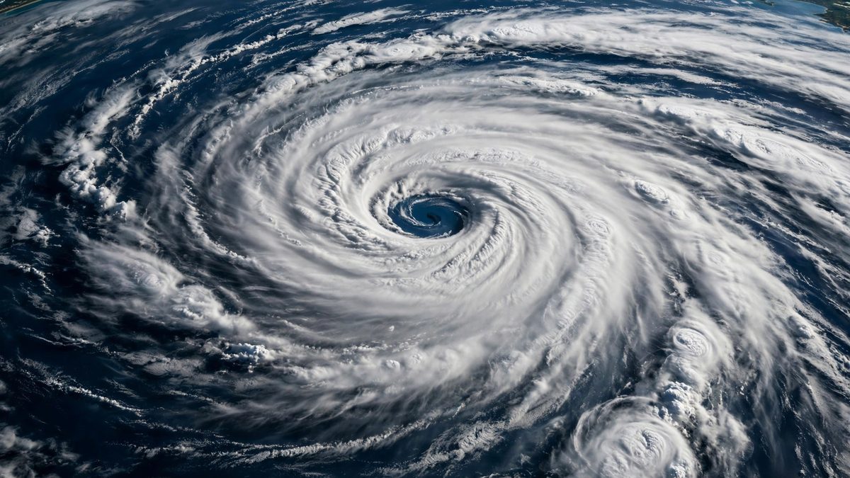
Key points
- *Updated 20:45 UTC, Saturday: Death toll rises to four as Isaias pushes inland*
- The death toll from Isaias doubled Saturday as the post-tropical remnants of the storm ground north through Alabama.
- Two of the deaths were in Alabama, Gov.
*Updated 20:45 UTC, Saturday: Death toll rises to four as Isaias pushes inland*
The death toll from Isaias doubled Saturday as the post-tropical remnants of the storm ground north through Alabama. Four people are dead, two in Alabama and two in Florida, and nearly 630,000 customers remained without power Saturday afternoon across Alabama, Florida and Georgia, the Wall Street Journal reported.
Two of the deaths were in Alabama, Gov. Kay Ivey said, without releasing details. Authorities said earlier that one was caused by a tree falling on a house.
In Florida, a woman died in Escambia County when a tree crashed through her home and pinned her beneath it; she was dead by the time fire rescue arrived, county sheriff's office spokeswoman Melony Peterson said. A second person was found dead in a garage with a generator running, Gov. Ron DeSantis said, and four members of that family were hospitalized. "Don't run the generator inside, it's something that can be fatal," DeSantis warned.
The storm's center was moving north over Alabama with winds near 35 mph Saturday afternoon, downgraded to a post-tropical cyclone. Forecasters expect it to reach the Tennessee Valley later Saturday and turn northeast Sunday. Up to 8 more inches of rain could fall over the weekend across southern Alabama, the Florida Panhandle and southwest Georgia, and rivers in the western Panhandle could flood, the National Weather Service said.
*Updated 18:28 UTC, Saturday: New detail on the Big Bend blow-through*
North Florida's cleanup got a clearer picture Saturday. In Tallahassee, firefighters answered a call on Cavalcade Trail minutes after Isaias came ashore: a tree had fallen on a house and set it on fire. Crews found smoke coming from the eaves and flames through the roof, with downed power lines nearby, and brought it under control despite heavy rain and wind, the Tallahassee Fire Department said. No one was hurt; the owner was outside, and the American Red Cross is assisting.
A feeder band parked over Madison and Taylor counties and dumped what forecasters called an extremely hazardous band of deluge before sliding east. A weather station near Jay recorded a 118 mph gust, showing the eyewall's power even after it moved inland, Fox Weather reported.
FEMA Region 4 Administrator Rob Ashe is at the State Emergency Operations Center in Tallahassee coordinating disaster staging assets and supply deliveries across the Panhandle, with ground-level damage assessments already underway. Florida CFO Blaise Ingoglia is setting up pop-up insurance villages so residents can get claims adjudicated quickly, Gov. Ron DeSantis said at his Saturday briefing.
More than 850,000 customers remained without power across Florida, Alabama and Georgia Saturday afternoon, and DeSantis said the flooding story is not over.
*Updated 16:56 UTC, Saturday: Outages top 850,000 as restoration begins*
Post-tropical Isaias kept pushing inland across the Southeast on Saturday afternoon, with more than 850,000 customers without power in Florida, Alabama and Georgia, the BBC reported. Other tallies ran a little higher: more than 858,000 homes and businesses across the three states were dark Saturday morning, according to PowerOutage.us figures carried by weather.com.
Florida had the largest share at about 436,000 customers, followed by Alabama with roughly 297,000 and Georgia with about 95,000.
Crews were already making progress. Nearly 100,000 homes and businesses had power restored by 10:30 a.m. ET, USA Today reported, down from about 900,000 an hour earlier.
Reuters reported that highways, bridges and airports were reopening as teams assessed damage. Florida staged 16,000 utility linemen ahead of the storm, Gov. Ron DeSantis said.
The danger is not over. The National Hurricane Center warned of continued flash-flood risk across southern Alabama, the Florida Panhandle and southwestern Georgia, and a tornado threat Saturday across the Panhandle, Georgia and the Carolinas. A flash flood warning was in effect for part of Atlanta until 1:15 p.m. EDT.
*Updated 16:15 UTC, Saturday: Cleanup begins as new storm details emerge*
More detail emerged Saturday afternoon on Isaias's path across the Gulf Coast. In Birmingham, a tree fell on a home on Monterey Drive after midnight, trapping two people; one was pronounced dead at the scene, Birmingham Fire and Rescue said. There was no immediate word on the condition of the second person.
Florida Lt. Gov. Jay Collins said about 900,000 people evacuated ahead of the storm. The state staged 16,000 utility linemen to restore power, Gov. Ron DeSantis said at a morning briefing.
Nearly 900,000 customers remained without power Saturday morning across Alabama, Florida and Georgia, according to outage tracker PowerOutage.com, the Wall Street Journal reported.
Tallahassee was spared the worst despite sitting on the storm's eastern side. The airport recorded 2.77 inches of rain through midnight. The Franklin County jail lost power when its backup generator failed. Flood warnings are in effect for the Ochlockonee River near State Road 20 and the St. Marks River near Newport. Both rivers are expected to crest near or above levels that flood nearby homes.
In Alabama, all roads in Houston County were closed until further notice, the state emergency management agency said, calling travel hazardous because of downed trees and power lines.
Isaias was the first Atlantic hurricane of 2026 and the first U.S. landfall in two years, breaking a streak that dated to Hurricane Milton in October 2024.
*Updated 14:30 UTC, Saturday: Post-tropical Isaias pushes into Alabama, death toll rises to two*
Post-Tropical Cyclone Isaias is charging inland over Alabama on Saturday morning, and the confirmed death toll has risen to two. A tree fell on a home in Birmingham, killing one person, according to reports from the New York Times, AL.com and WVTM 13, which cite Jefferson County emergency management and the Birmingham fire department. A second death was confirmed in Escambia County, Florida, authorities told USA Today.
The National Hurricane Center issued its final advisory on Isaias at 4 a.m. CT Saturday, when the storm was a post-tropical cyclone with 35 mph winds about 40 miles south-southwest of Montgomery. The remnants were expected to reach the Tennessee Valley later Saturday and turn northeast on Sunday.
Florida Gov. Ron DeSantis said at an Oct. 10 morning briefing that the storm had left Florida but the flooding story is not over, with 4 to 8 inches of rain forecast across the Panhandle and Big Bend. He said 448,000 accounts were without power at 7 a.m. ET, mainly in northwest Florida, and that all state-owned bridges had reopened along with Interstate 10 and U.S. 98. No search-and-rescue requests had been received, which he called an optimistic sign.
More than a foot of rain fell in Bellwood, Alabama, and Defuniak Springs, Florida, Fox Weather reported. A Level 3-of-4 flash flood risk covers northern Georgia and the Blue Ridge on Saturday, including Atlanta and Asheville.
President Donald Trump said his administration was watching the storm closely and called it under control, Reuters reported.
*Developing story: Updated 13:07 UTC, Saturday*
Isaias came ashore near Destin, Florida, around 8:30 p.m. Central time Friday as a Category 2 hurricane with 105 mph sustained winds, the National Hurricane Center said. By late Friday night it had weakened to a Category 1 with 90 mph winds as it pushed inland, and by Saturday morning it was a post-tropical cyclone: the Hurricane Center issued its final advisory around 4 a.m. Central time, when the storm sat about 40 miles south-southwest of Montgomery, Alabama, with winds down to 35 mph.
More than 600,000 customers across Florida, Alabama and Georgia lost power. Outage trackers showed over 450,000 without electricity in Florida alone, with the hardest hits in Panhandle counties: Walton at 95 percent, Liberty at 97 percent, Escambia at 73 percent, Okaloosa at 67 percent and Bay at 39 percent. Alabama and Georgia counted tens of thousands more outages, and utilities warned repairs could take days for many customers.
Florida Lt. Gov. Jay Collins told Fox News the storm "hit like a freight train," and said about 900,000 people evacuated before landfall. In Alabama, Houston County closed all roads after downed trees and power lines made travel hazardous. In Pensacola, a police officer pulled a man from a burning house after regular emergency response had been suspended for high winds; both were treated for smoke inhalation.
The danger is now spreading inland. Forecasters issued a rare Level 4 flash flood threat, the highest category, for parts of the Florida Panhandle, the Big Bend, southern Georgia and southeastern Alabama, warning of 10 or more inches of rain and life-threatening flash flooding into Saturday morning. President Donald Trump approved federal disaster assistance for 27 Florida counties, with FEMA authorized to provide emergency protective measures at 75 percent federal funding.
Wind reports traced the storm's violent arrival. A station near Santa Rosa Sound measured a 116 mph gust, and a gauge at Panama City Beach recorded water 5.6 feet above mean higher high water. Isaias is the first U.S. hurricane landfall since Hurricane Milton struck Siesta Key, Florida, exactly two years earlier, on Oct. 9, 2024. Confirmed casualty and damage details were not yet available early Saturday; this story will be updated as verified information emerges.
Landfall imminent: Isaias weakened to a Category 2 hurricane with 110 mph winds as its northern eyewall came ashore on the Florida Panhandle, the National Hurricane Center said in its 7 p.m. CT advisory. The center was about 40 miles south of Pensacola. The National Weather Service issued an Extreme Wind Warning for coastal Escambia, Santa Rosa, Okaloosa, and Walton counties, with gusts up to 115 mph possible through 9 p.m. CT, and forecasters expect landfall near Destin within the next two hours. Top gusts so far include 92 mph in Pensacola and 76 mph in Destin, and storm surge was already pushing four feet above normal high tide at Panama City Beach. Earlier, NHC deputy director Jamie Rhome warned conditions were going downhill "very, very rapidly," and about two million people across the Panhandle and southern Georgia are under a tornado watch, USA Today reported.
Night update: Isaias is lashing the northern Gulf Coast with strong winds and heavy rain as its center closes in on landfall, forecasters said Friday evening. The storm's center is expected to come ashore late tonight between Mobile, Alabama, and Grayton Beach, Florida, most likely between 9 and 11 p.m. ET. Tens of thousands of people across the Florida Panhandle and Alabama's Gulf Coast are under mandatory evacuation orders, and highways heading north were packed with evacuees, Reuters reported. "If you've been asked to evacuate, get out now, conditions are only going to deteriorate," National Hurricane Center Director Michael Brennan told Fox Weather. Brennan warned the storm surge would arrive after dark, a dangerous combination. Florida Gov. Ron DeSantis urged residents to assume they would lose power and added: "you hide from the wind, but you run from the water." President Donald Trump canceled a planned Saturday trip to Tuscaloosa, Alabama, where he had planned to attend the Georgia-Alabama college football game. Oil companies have evacuated crews from 129 production platforms in the Gulf, about 35 percent of the 371 staffed platforms. After landfall, the storm is expected to weaken and push north toward Atlanta, where it could drop up to 8 inches of rain, before downgrading to a tropical storm Saturday afternoon.
Evening update: As of 6 p.m. ET, Isaias was centered about 70 miles south of Pensacola with maximum sustained winds of 115 mph, moving north at around 17 mph, the National Hurricane Center said. Hurricane-force wind gusts were already being felt along the northern Gulf Coast, and forecasters expect the storm to be at or near major-hurricane strength at landfall this evening. The hurricane center boosted its storm surge forecast to up to 9 feet from the Alabama-Florida border to Grayton Beach, and warned of 4 to 8 inches of rain, up to 15 inches locally, across the Panhandle and Big Bend, with isolated tornadoes possible overnight.
Hurricane Isaias has strengthened into a major hurricane with maximum sustained winds near 120 mph, just-received data from an Air Force Reserve Hurricane Hunter aircraft showed Friday morning, the National Hurricane Center said. As of 8 a.m. ET, the storm was centered about 170 miles south-southeast of the mouth of the Mississippi River, moving north-northeast at 15 mph. The hurricane center expects landfall near Pensacola, Florida, tonight, the storm's center was forecast about 30 miles south of Pensacola Beach around 7 p.m. ET, with landfall following a couple of hours later at roughly 100 mph with higher gusts.
Forecasters expect Isaias to reach Category 3 strength during the day Friday, peaking near 120 mph, before increasing wind shear weakens it somewhat ahead of landfall, but it is still expected to be a dangerous hurricane when it makes landfall. "Preparations should be rushed to completion as the weather will go downhill quickly today," the hurricane center said early Friday.
As of 8 a.m. ET, the center of Isaias was about 170 miles south-southeast of the mouth of the Mississippi River, moving north-northeast at 15 mph. Hurricane-force winds extend outward up to 30 miles from the center and tropical-storm-force winds extend outward up to 185 miles, the hurricane center said.
Warnings stretch across the northern Gulf
A hurricane warning is in effect from Ocean Springs, Mississippi, to the Bay/Gulf County line in Florida, meaning hurricane conditions are expected within 24 hours. A storm surge warning covers the mouth of the Mississippi River to the Suwannee River in Florida, where forecasters warn of life-threatening inundation of 5 to 7 feet above normally dry ground in the hardest-hit areas.
Tropical storm warnings extend from the Jefferson/Plaquemines Parish line in Louisiana to west of Ocean Springs, and east of the Bay/Gulf County line to the Aucilla River in Florida. A storm surge watch is in effect from the Suwannee River to Yankeetown.
Rainfall of 3 to 7 inches is expected across the region, with isolated totals of 10 inches. Tornadoes are also possible as the storm moves ashore. The National Weather Service warned communities from Ocean Springs to Gulf County, Florida, to prepare for the possibility of long-duration power outages.
Evacuations and emergencies
Mandatory evacuations are in effect across Florida's Panhandle. Okaloosa County ordered residents of coastal Zones A and B to leave starting at noon Thursday; Escambia and Santa Rosa counties issued evacuation orders for Zones A and B; Franklin County ordered evacuations for barrier islands, low-lying areas, mobile homes and RV parks; and Walton County ordered evacuations in zones A, B and C. Bay County issued a voluntary evacuation for Zones A and B. Tourists were urged to leave the area, and Okaloosa County planned to close three airports Thursday evening.
In Alabama, Dauphin Island ordered an evacuation of the western part of the barrier island Thursday evening, and Baldwin County encouraged residents of low-lying coastal areas to evacuate voluntarily, with shelters prepared.
Florida Gov. Ron DeSantis declared a state of emergency in 25 counties, and Alabama Gov. Kay Ivey declared a state of emergency covering 40 counties. In Mississippi, Jackson County and the city of Gautier declared local emergencies. At least four Florida school districts canceled classes, according to the Associated Press.
Why it matters
Isaias is the first Atlantic hurricane of the 2026 season and the ninth named storm. It became a hurricane shortly before midnight on October 7, nearly tying the record for the latest-arriving first Atlantic hurricane, a mark set on October 8, 1905. A strong El Niño pattern has suppressed Atlantic development this year by increasing vertical wind shear, which tears apart forming storms.
The storm is already disrupting energy production. About 62.9 percent of daily Gulf of Mexico oil production, roughly 1.28 million barrels per day, was shut in Thursday, along with 57.4 percent of natural gas output, as operators evacuated 121 production platforms, nearly a third of the 371 manned platforms in the Gulf. Shell and Chevron said they were curtailing offshore operations.
What happens next
Isaias has now reached major-hurricane strength, and forecasters expect it to touch Category 3 during the day Friday, peaking near 120 mph, before increasing wind shear weakens it somewhat ahead of landfall; it is still expected to be a dangerous hurricane when it makes landfall. The projected landfall zone stretches from Mobile, Alabama, to Panama City, Florida, with the Pensacola area near the center of the forecast cone.
"We are expecting Isaias to be a dangerous hurricane when it makes landfall," NHC Director Michael Brennan said Thursday. "Today is the day to prepare and get ready."
Key numbers
- 110 mph: maximum sustained winds at 7 p.m. CT (Category 2)
- 40 miles: center's distance south of Pensacola at 7 p.m. CT
- 115 mph: maximum gusts under Extreme Wind Warning (coastal Escambia, Santa Rosa, Okaloosa, Walton) through 9 p.m. CT
- 4 feet: surge already above normal high tide at Panama City Beach
- 9 feet: forecast storm surge, Alabama-Florida border to Grayton Beach
- 4–15 inches: forecast rainfall (15 inches locally)
- ~8 p.m. ET: expected landfall near Destin
- 129: Gulf production platforms evacuated (~35% of staffed platforms)
- 963 mb: minimum central pressure
Watch
Timeline
- Oct 7, 2026Isaias becomes the first Atlantic hurricane of the 2026 season shortly before midnight, reaching Category 1 strength in the Gulf of Mexico.
- Oct 8, 2026Winds reach 85 mph Thursday morning; mandatory evacuations are ordered in parts of Florida's Panhandle; Florida and Alabama states of emergency are in effect.
- Oct 9, 20264 a.m. CDT advisory: Isaias is a 110-mph Category 2 hurricane, 200 miles south-southeast of the Mississippi River mouth, moving north-northeast at 15 mph; landfall expected late Friday or early Saturday.
- Oct 9, 2026Morning update: NHC says Isaias is likely to become a major hurricane today, forecasting a peak near 120 mph (Category 3); landfall still expected tonight or early Saturday.
- Oct 9, 2026Friday morning update: the 4 a.m. CT advisory puts Isaias at 110 mph (Category 2), 282 miles south of Pensacola and moving north-northeast at 15 mph; the NHC forecasts a peak of 120 mph (Category 3) today before wind shear weakens it somewhat. Landfall is expected tonight between Mobile, Alabama, and Destin, Florida, near Pensacola, with life-threatening storm surge up to 7 feet. Florida Gov. Ron DeSantis expanded the state's emergency declaration to 27 North Florida counties.
- Oct 9, 2026Friday morning update: Air Force Reserve Hurricane Hunter data show Isaias has reached major-hurricane strength with maximum sustained winds near 120 mph; the NHC forecasts Category 3 strength during the day, weakening slightly to about 100 mph at landfall near Pensacola tonight.
- Oct 9, 2026Evening update: the 6 p.m. ET advisory puts Isaias about 70 miles south of Pensacola with 115 mph winds, moving north at 17 mph; hurricane-force gusts are already reaching the northern Gulf Coast; the NHC raises the storm surge forecast to up to 9 feet from the Alabama-Florida border to Grayton Beach and warns of 4 to 8 inches of rain, up to 15 inches locally, with isolated tornadoes possible overnight.
- Oct 9, 2026Night update: Isaias lashes the northern Gulf Coast with wind and rain; landfall expected late tonight between Mobile, Alabama, and Grayton Beach, Florida (most likely 9–11 p.m. ET); President Trump cancels Saturday's Alabama trip; 129 Gulf platforms evacuated; the storm is forecast to weaken and drop up to 8 inches of rain near Atlanta before downgrading Saturday afternoon.
- Oct 9, 2026Late-evening update: the 7 p.m. CT advisory weakens Isaias to a 110-mph Category 2 hurricane 40 miles south of Pensacola; the northern eyewall comes ashore in Escambia, Santa Rosa, Okaloosa, and Walton counties; an Extreme Wind Warning covers the coast with gusts up to 115 mph through 9 p.m. CT; landfall expected near Destin within two hours; surge pushes 4 feet above normal high tide at Panama City Beach.
- Oct 10, 2026Saturday-morning update: Isaias makes landfall near Destin at 8:30 p.m. CT Friday (01:30 UTC) as a 105-mph Category 2, weakens to a Category 1 overnight and to a post-tropical cyclone Saturday morning; the NHC issues its final advisory around 4 a.m. CT; more than 600,000 lose power across Florida, Alabama and Georgia; a rare Level 4 flash flood threat is issued for the Panhandle, Big Bend, southern Georgia and southeastern Alabama.
- Oct 10, 2026NHC issues its final advisory on Isaias as a post-tropical cyclone over Alabama; the confirmed death toll rises to two, with deaths in Escambia County, Florida, and Birmingham, Alabama, where a tree fell on a home.
- Oct 10, 2026DeSantis morning briefing: 448,000 accounts without power at 7 a.m. ET, all state bridges and I-10/US 98 reopened, no search-and-rescue requests; flood threat continues with more than a foot of rain in parts of Alabama and Florida.
- Oct 10, 2026Saturday-afternoon update: fire officials detail the Birmingham death (tree fell on a Monterey Drive home after midnight, two trapped, one dead); Houston County, Alabama, closes all roads; Franklin County jail loses power after its backup generator fails; river flood warnings issued near Tallahassee; Collins says about 900,000 evacuated ahead of landfall; first U.S. hurricane landfall since Milton in October 2024.
- Oct 10, 2026Saturday-afternoon update: outage tallies top 850,000 across Florida, Alabama and Georgia (BBC); weather.com cites PowerOutage.us at more than 858,000, with Florida 436,000, Alabama 297,000 and Georgia 95,000; USA Today reports nearly 100,000 customers restored by 10:30 a.m. ET; highways, bridges and airports reopening as damage assessment continues; flash-flood warning in effect for part of Atlanta; tornado threat persists across the Southeast.
- Oct 10, 2026Saturday-evening update: Tallahassee firefighters extinguished a house fire on Cavalcade Trail after a fallen tree ignited it, with no injuries; a 118 mph gust was recorded near Jay; FEMA Region 4 set up at the State EOC in Tallahassee to coordinate Panhandle relief; Florida's CFO announced pop-up insurance villages; outages held above 850,000 across three states.
- Oct 10, 2026Saturday-evening update: death toll rises to four, two each in Alabama and Florida; Escambia County victims include a woman pinned under a fallen tree and a generator-fume death, with four family members hospitalized; nearly 630,000 customers remain without power across three states; the post-tropical cyclone pushes north through Alabama toward the Tennessee Valley.
Sources
- National Hurricane Center: Hurricane Isaias Advisory Number 11
- Reuters: Hurricane Isaias strengthens as US Gulf Coast prepares for landfall
- Associated Press: Hurricane Isaias nears Gulf Coast, bringing surge and evacuation orders
- Pensacola News Journal: Hurricane Isaias live updates
- FOX Weather: Live updates: Deadly post-tropical Isaias charges inland, unleashing vicious impacts on the South
- USA Today: Hurricane Isaias now a major hurricane; landfall expected tonight
- CBS News: Hurricane Isaias intensifies as it threatens northern Gulf Coast
- Reuters: Boarded windows and evacuations as major hurricane nears US Gulf coast
- NY Post: 'Life-threatening' Hurricane Isaias churns toward Gulf Coast with Category 3 strength
- NPR/WAMC: 'Life-threatening' Isaias, a major hurricane, starts to affect Gulf Coast
- Tallahassee Democrat: Hurricane Isaias live updates
- Montgomery Advertiser: Hurricane Isaias update, when is Alabama landfall expected
- Reuters: Hurricane Isaias weakened to a Category 1 storm, NHC says
- FOX Weather: Live updates: Deadly post-tropical Isaias charges inland, unleashing vicious impacts on the South
- New York Post: Hurricane Isaias hit Florida 'like a freight train', killing 4 as storm leaves 800K without power
- NPR: 'Life-threatening' Isaias, a major hurricane, starts to affect Gulf Coast
- Pensacola News Journal: Live updates, Hurricane Isaias makes landfall in Florida with 105 mph winds
- weather.com: Hurricane Isaias batters Florida, Georgia, Alabama
- The Chronicle: Hurricane Isaias hits US Gulf Coast, triggers evacuations and power outages
- Times Now World: Hurricane Isaias leaves hundreds of thousands without power across Gulf Coast
- USA Today: Isaias live updates: 4 dead, mass power outages after hurricane roars ashore
- Pensacola News Journal: Live: Isaias moves out of Florida, downgraded to post-tropical
- Reuters (via WABX): Isaias weakens to post-tropical cyclone after Florida landfall
- Wall Street Journal: Four Dead After Isaias Crashes Into Gulf Coast
- Tallahassee Democrat: Isaias spares Tallahassee, topples trees and creates power struggle
- Reuters: Isaias kills two, leaves thousands without power after landfall
- WBRC/Gray News: 2 killed by fallen trees since Isaias made landfall on Gulf Coast
- BBC: Hurricane Isaias: More than 850,000 households without power in Alabama, Florida and Georgia
- weather.com: Nearly 900,000 lose power as Isaias pushes across Southeast (live updates)
- weather.com: Isaias inland threats: Southeast flooding, wind, tornadoes
- Pensacola News Journal: Hurricane Isaias damage photos in Florida, Alabama, after landfall in Destin
- Pensacola News Journal: Isaias leaves 900,000 without power. When will yours be back on?