
Category 5 Cyclone Xavier Batters the Northern Cook Islands
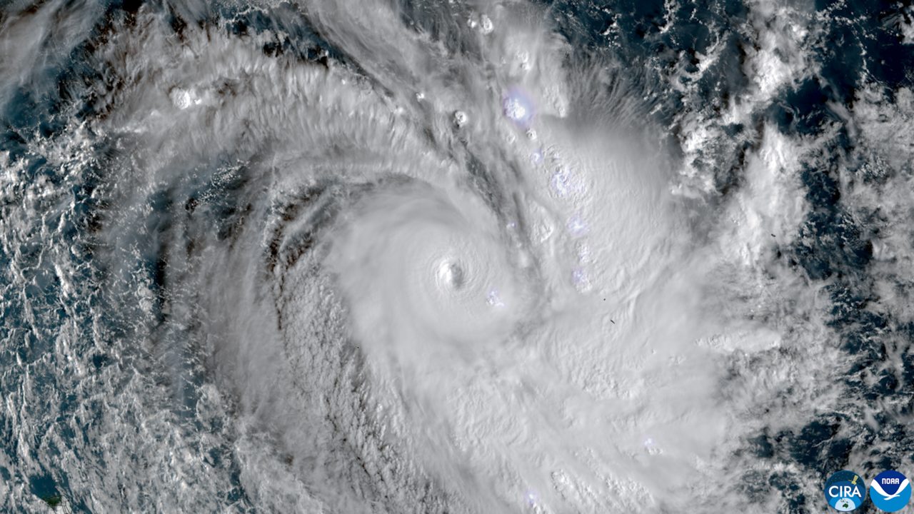
Xavier is holding Category 5 strength at 910 hPa northeast of Pukapuka, with winds of 220 km/h, gusts to 315 km/h, and gale warnings across the Northern Cook Islands.
Key points
- Severe Tropical Cyclone Xavier is a Category 5 storm sitting over the Northern Cook Islands with maximum winds near its centre of 220 km/h and a central pressure of 910 hPa.
- The Fiji Meteorological Service reported sustained winds of about 220 km/h near the centre with gusts to 315 km/h.
- MetService expects Xavier to hold Category 5 intensity for most of Thursday, move slowly southwest, and begin weakening from late Thursday.
Severe Tropical Cyclone Xavier is a Category 5 storm sitting over the Northern Cook Islands with maximum winds near its centre of 220 km/h and a central pressure of 910 hPa. New Zealand's MetService placed the storm near 9.7S 163.6W in its latest bulletin, about 280 km northeast of Pukapuka and 300 km north-northwest of Manihiki Atoll, moving slowly southwest.
The Fiji Meteorological Service reported sustained winds of about 220 km/h near the centre with gusts to 315 km/h. RNZ reported gale warnings in force for Pukapuka and Nassau and a strong wind warning for Manihiki, and shelters were activated across the Northern Cook Islands as the storm approached. In an earlier update, the NZ Herald reported Xavier battering the islands with gusts up to 295 km/h. A Manihiki resident said the worst was over for his island. No casualties had been reported in the reports read, though weather summaries citing 1News and PMN reported damage to the wharf on Manihiki.
What happens next
MetService expects Xavier to hold Category 5 intensity for most of Thursday, move slowly southwest, and begin weakening from late Thursday. Over the weekend the storm is forecast to track toward Samoa in a weakened state, still bringing strong winds, heavy rain and large waves to islands in its path. The Northern Cook Islands are a chain of low atolls spread across a wide stretch of the South Pacific, and the islands closest to the track, Pukapuka, Nassau and Manihiki, face the sharpest conditions while the storm stays near full strength.
Warnings stay up
Gale warnings remain in place for Pukapuka and Nassau, with a strong wind warning for Manihiki. Residents on the atolls have been urged to stay in shelter while the strongest winds pass. MetService and the Fiji Meteorological Service, which has jurisdiction for this part of the Pacific, are issuing regular updates on the storm's position and strength, and the next track will show how fast the weakening begins.
The storm by the numbers
Xavier's central pressure of 910 hPa marks it as a deep and intense system. MetService put maximum winds near the centre at 120 knots, which is the 220 km/h figure the Fiji Meteorological Service reported, with gusts to 315 km/h in its update. The storm's centre sat about 280 km northeast of Pukapuka and 300 km north-northwest of Manihiki when the bulletin was issued, close enough for both atolls to sit under formal warnings while the centre stayed over open water.
Timeline
- Nov 17, 2026NZ Herald reports Xavier battering the Northern Cook Islands with gusts up to 295 km/h. A Manihiki resident says the worst is over for his island.
- Nov 18, 2026MetService places Category 5 Xavier at 910 hPa near 9.7S 163.6W, about 280 km northeast of Pukapuka, with winds of 220 km/h and gusts to 315 km/h reported by the Fiji Meteorological Service.
- Nov 19, 2026Forecast: Xavier holds Category 5 for most of Thursday, then begins weakening from late Thursday.
- Nov 21, 2026Forecast: the weakened storm tracks toward Samoa over the weekend, still bringing strong winds, heavy rain and large waves.